
The GIS software landscape is shifting rapidly. For organizations managing large-scale geospatial systems—like utility companies and FTTH network providers—the demand is clear: they need flexible, scalable, and cost-effective solutions. Legacy proprietary platforms, once the standard, now pose growing challenges with their high licensing costs and limited adaptability.
Open-source GIS platforms deliver a robust, enterprise-grade alternative. They empower organizations with full control over data and workflows, slash long-term costs, and support faster, more adaptive system evolution—critical in today’s dynamic operational environments.
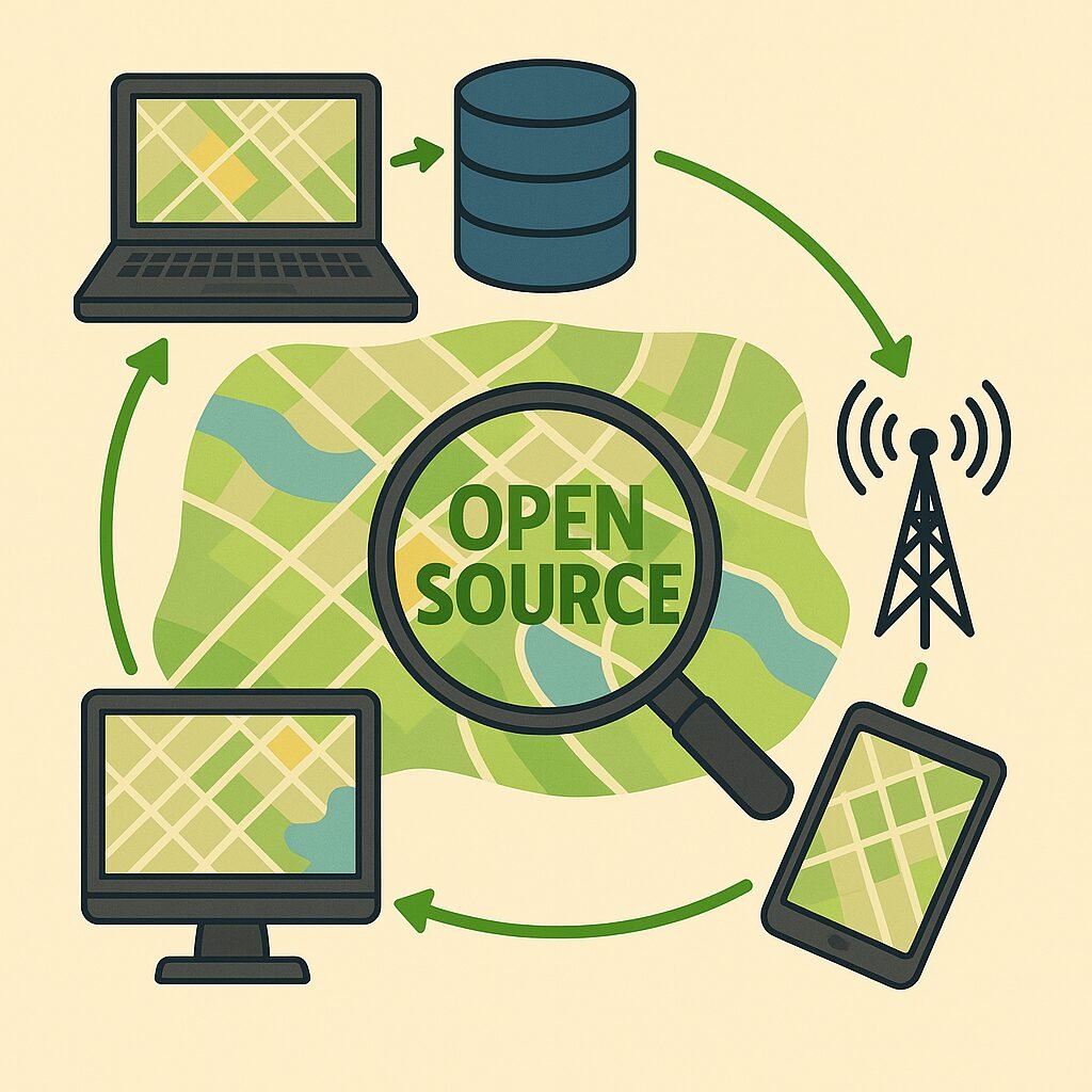
This ecosystem of open-source tools is already transforming how enterprises manage and scale their geospatial operations.

Business Drivers for Open-Source GIS Adoption
Organizations are embracing open-source GIS not just for ideology, but because it delivers tangible business value. Here are the key drivers behind its rapid adoption:
- Cost Management: Open-source GIS eliminates recurring per-user, per-server, and per-extension fees. This enables stable long-term budgeting.
- Technology Independence: Systems built on open standards (e.g., OGC-compliant formats) allow full control over data, workflows, and system evolution, avoiding vendor lock-in.
- Customization and Agility: Enterprises retain full freedom to configure, extend, and integrate systems based on operational requirements — without waiting for vendor updates or paying for change requests.
- Security and Auditability: The transparent nature of open-source software allows for full code access, independent security audits, and alignment with internal compliance standards.
- Scalability Without Penalty: Expanding the system to more users, devices, or data volumes does not increase software costs — infrastructure growth becomes predictable and manageable.
These drivers aren’t theoretical—they’re drawn from real-world deployments across telecom, utilities, infrastructure, and government sectors that have adopted open GIS frameworks.
Practical Benefits for Utilities and FTTH Providers
Open-source GIS directly addresses the realities of utility and FTTH operations—where infrastructure is complex, field teams are distributed, and rapid responsiveness is essential.
By leveraging centralized systems for asset management, organizations can achieve better oversight and streamline decision-making across distributed networks. Field teams are empowered to collect and validate data in real time, enabling accurate updates and more efficient project execution. Access to live network information supports seamless collaboration between planners, engineers, and contractors, while integrated workflows improve the efficiency of planning, verification, and reporting.
Open-source tools can be seamlessly connected to cover the entire lifecycle—from mobile data collection and desktop editing to web access and real-time reporting through dashboards.

Real Business Impacts Observed in Open-Source GIS Deployments
Open-source GIS consistently delivers measurable operational improvements—grounded in real system behavior and project performance metrics.
- Enterprises remove dependency on recurring license negotiations and payment cycles. This frees budget for system enhancements and operational use cases.
- Deployment timelines are reduced by using modular architectures and standards-compliant APIs. Organizations can integrate external data, automate planning tools, and roll out new services more quickly.
- Internal teams manage system evolution directly. Upgrades, integrations, and custom tool development are executed without vendor gatekeeping or contractual delays.
- Scaling the system to support more assets, more users, or higher geographic coverage is based on infrastructure, not licensing models.
Business value is unlocked through efficiency, strategic control, and freedom from vendor-imposed limitations—not just through reduced software costs, but by removing barriers to agility.
Addressing Security and Support Considerations
Security is a top priority for infrastructure owners. Open-source GIS systems meet — and often exceed — enterprise security expectations when deployed correctly.
The following capabilities highlight how open-source GIS platforms address critical security and support requirements in enterprise environments:
- Secure Communications: All major open-source GIS components support SSL/TLS, ensuring secure data transmission.
- User and Role Management: Enterprise authentication systems (e.g., LDAP, OAuth) can be integrated to enforce access control policies.
- Auditable Systems: Full source code access allows internal or third-party security audits — essential for compliance-heavy environments.
- Vendor-Independent Support: Certified partners offer SLA-based support, managed services, monitoring, and long-term maintenance strategies tailored to enterprise needs.
Security and continuity are achieved not through licensing, but through proper architecture, governance, and support models — all of which are fully compatible with open-source systems.

Open Source GIS vs. Proprietary Platforms: A Strategic Comparison
When comparing open-source and proprietary GIS systems, the strategic differences are clear:
- Cost Predictability: Open-source GIS has no user-based license fees. Proprietary systems often scale costs with user count, server capacity, or feature access.
- Data Ownership: Open-source GIS stores and serves data in open formats under your control. Proprietary systems often use custom formats or restrict database-level access.
- System Flexibility: Open GIS stacks are fully customizable — integrations, automations, and UI modifications are developed internally or with partners. Proprietary systems impose platform limits and require vendor-delivered customizations.
- Security Auditability: Open-source codebases can be reviewed, patched, and validated internally. Proprietary systems require trust in the vendor’s internal processes.
- Roadmap Control: In open systems, the organization drives roadmap priorities. In proprietary systems, product evolution depends on vendor timelines.
These differences directly affect total cost of ownership, agility, and long-term success—especially in data-intensive, field-centric sectors like utilities and telecoms.
Scaling Open-Source GIS with Confidence: Our Full-Lifecycle Support Approach
Geospatial Net delivers full-lifecycle support for enterprise-grade open-source GIS environments—designed for scalability, integration, and long-term impact.
We offer:
Architecture Design: Modular, scalable systems tailored for your operational needs.
Implementation: Secure deployment on cloud or on-premises infrastructure with automation and version control.
Migration Services: Transition from proprietary formats and systems into standards-compliant, open GIS environments.
Workflow Automation: Streamlined tools for asset planning, QA/QC reporting, field data validation, and process efficiency.
Reporting & Dashboards: Custom visual reporting solutions built around your KPIs, helping stakeholders monitor, act, and plan with confidence.
Support & Maintenance: Ongoing services including system health checks, monitoring, updates, and feature extensions — all under defined SLA agreements.
Expert Support: Access to industry insight and engineering expertise throughout every phase—from initial design through deployment and beyond.
Our goal is to empower your GIS to drive business results—without being slowed down by licensing limits, vendor delays, or rigid platforms.

Build a Smarter GIS System — Without Unnecessary Overhead
Open-source GIS is not a budget compromise — it’s a strategic investment in system control, operational efficiency, and long-term sustainability.
Enterprises across utilities, FTTH, infrastructure, and asset management can confidently transition to open platforms—without sacrificing capabilities, performance, or security.
The key is smart design, professional implementation, and long-term support—tailored to your operational goals, not restricted by licensing limits or vendor timelines.
Ready to modernize your GIS? Talk to Geospatial Net and start building a system you fully control — on your terms, at your pace.
